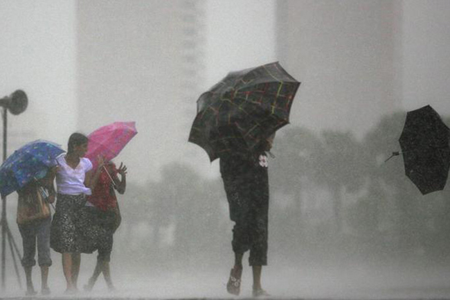
Showery and windy condition to enhance over next few days
September 18, 2020 08:27 am
Windy condition over the island and the showery condition over the south-western parts are expected to enhance temporary to some extent from today (18) to 21 September, says the Department of Meterology.
Showers will occur at times in Central, Sabaragamuwa, Western and North-western provinces and in Galle and Matara districts. Heavy rainfall above 100 mm is likely at some places.
Several spells of showers will occur in the North-central province.
Showers or thundershowers may occur at a few places in Uva province and in Ampara district after 2.00 pm.
Strong gusty winds about (50-60) kmph can be expected across the island, particularly in the Northern, North-central and North-western provinces, Trincomalee and Hambanthota districts and in the western slopes of the central hills.
Sea areas:
Showers or thundershowers may occur at several places in the sea areas off the coast extending from Puttalam to Hambantota via Colombo and Galle. Heavy rainfall are likely at some places.
Winds will be south-westerly in the sea areas around the island and the wind speed will be (30-40) kmph.
Wind speed can increase up to (60-70) kmph in the deep and shallow sea areas off the coasts extending from Trincomalee to Negombo via Kankesanturai and Puttalam and in the sea area extending from Matara to Pottuvil via Hambantota.
Wind speed can increase up to (50-55) kmph in the deep and shallow sea areas off the coasts extending from Negombo to Matara via Colombo and Galle
It is possible that nearshore sea areas off the coast extending from Kalpitiya to Pottuvil via Colombo, Galle and Hambantota may experience surges due to the effect of swell waves, having 2.5 – 3.0 m height.
The sea areas extending from Trincomalee to Negombo via Kankesanturai and Puttalam and the sea area extending from Matara to Pottuvil via Hambantota can be rough or very rough at times.
The other sea areas around the island can be fairly rough or rough at times.