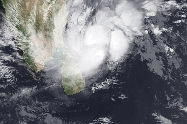
Impact of Cyclone Nivar on the island expected to decrease gradually
November 26, 2020 08:10 am
The Severe Cyclonic Storm ‘Nivar’ which was located over the southwest Bay of Bengal has made landfall off the coast Tamil Nadu of India, moves north-westwards and gradually weakening, the Department of Meteorology says.
The influence on the weather over the island from this cyclonic storm will be gradually reduced.
Several spells of showers will occur in North-western, Western and Sabaragamuwa provinces and in Jaffna, Mannar, Galle and Matara districts.
Showers or thundershowers may occur at a few places in Uva province and in Ampara and Batticaloa districts after 2.00 p.m.
The general public has been requested to take adequate precautions to minimize damages caused by temporary localized strong winds and lightning during thundershowers.
Sea areas:
Showers or thundershowers will occur in the sea areas extending from Puttalam to Trincomalee via Mannar and Kankesanturai and in the sea areas extending from Colombo to Pottuvil via Galle and Matara.
Winds will be south-westerly to southerly in the sea areas around the island and the wind speed will be (20-30) kmph.
Wind speed can increase up to (40-50) kmph in the sea areas off the coasts extending from Puttalam to Trincomalee via Mannar and Kankesanturai.
The sea areas off the coasts extending from Puttalam to Trincomalee via Mannar and Kankesanturai can be fairly rough at times. Other sea areas around the island will be moderate.
Temporarily strong gusty winds (up to 70-80 kmph) and very rough seas can be expected during thundershowers.


