Low-pressure area in Bay of Bengal likely to intensify into cyclonic storm
December 3, 2021 07:22 am
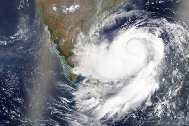
The low-pressure area over south-east Bay of Bengal concentrated into a Depression and lay centered near Lat. 12.0°N and Long. 87.5°E at 23:30 on 02 December, says the Department of Meteorology.
It is likely to move north-westwards and intensify into a Cyclonic Storm over central parts of the Bay of Bengal during the next 24 hours. Subsequently, it is expected to reach west-central Bay of Bengal off north Andhra Pradesh - south Odisha coasts in the early hours of 04 December.
Naval and fishing communities who are in the deep sea of the Central Bay of Bengal are advised to be attentive in this regard.
Meanwhile, showers or thundershowers will occur at several places in the sea areas extending from Galle to Pottuvil via Matara and Hambantota during the night. Showers or thundershowers are possible in parts of other sea areas around the island.
Winds will be mainly north-easterly in direction and the wind speed will be 20-30 kmph in the sea areas around the island.
The sea areas around the island will be slight.
Temporarily strong gusty winds and very rough seas can be expected during thundershowers.
Land areas:
Showers or thundershowers will occur at several places in Sabaragamuwa, Central, Uva, Southern and Western provinces during the evening or night.
A few showers are likely in the Northern and North-central provinces.
Misty conditions can be expected at some places in Western, Uva, Central and Sabaragamuwa provinces during the morning.