Bay of Bengal low-pressure area likely to intensify; prevailing showers to enhance
December 1, 2023 08:28 am
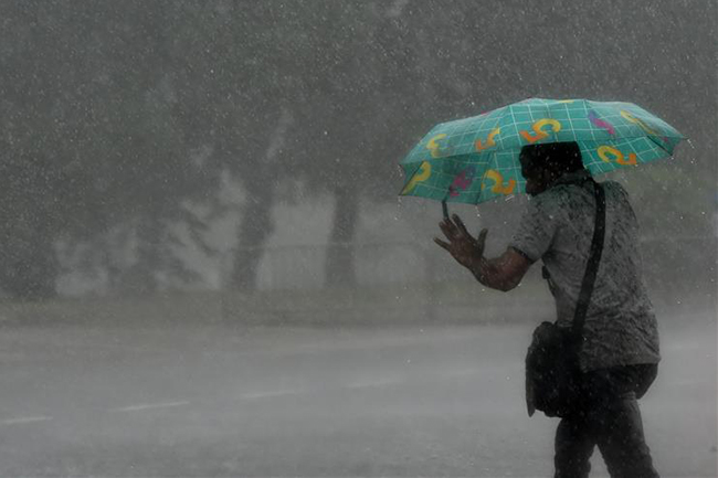
Prevailing showery condition is expected to further enhance across the island due to the low-pressure area over southeast Bay of Bengal, the Department of Meteorology said in its forecast today.
As such, showers or thundershowers are anticipated today in the Northern, North-central and Eastern provinces.
Meanwhile, heavy showers of about 100mm are likely at some places in the Eastern Province and Polonnaruwa and Mullaitivu districts.
Showers or thundershowers will occur at several places in other provinces of the island after 1:00 p.m. Fairly heavy showers of about 75mm are likely at some places in Western and Sabaragamuwa provinces and Galle and Matara districts.
Showers may occur in the Southern Province during the morning too.
The members of the public are advised to take adequate precautions to minimize damages caused by temporary localized strong winds and lightning during thundershowers.
Sea areas:
A low-pressure area was located over south Andaman Sea and adjoining southeast Bay of Bengal is likely to move west and northwestward and intensify into a depression over South-east Bay of Bengal within next few hours and it will further develop in to a cyclonic storm.
The Met. Dept. warned that it is dangerous to engage in activities in the sea areas off the coast extending from Mannar to Batticaloa via Kankesanthurai and Trincomalee. As such, naval and fishing communities have been advised not to venture into the aforementioned sea areas until further notice.
Fishing and naval communities are further urged to be attentive to future forecasts issued by the Department of Meteorology in this regard.
Showers or thunder showers will occur at times off the coast extending from Puttalam to Galle via Mannar, Kankesanthurai, Trincomalee, Pottuvil and Hambantota. Showers or thundershowers will occur at several places in the other sea areas around the island particularly during the evening or night.
Winds will be north-easterly and wind speed will be 30-40 kmph in the sea areas off the coast extending from Galle to Batticaloa to via Colombo, Puttalam, Kankesanthurai and Trincomalee. Wind speed may increase up to 60-70 kmph in the sea areas off the coast extending from Mannar to Batticaloa via Kankesanthurai and Trincomalee.
Winds will be south-westerly or variable in direction in the other sea areas around the island and wind speed will be 20-30 kmph.
The sea areas off the coast extending from extending from Mannar to Batticaloa via Kankesanthurai and Trincomalee will be rough. The other sea areas around the Island may be fairly rough.
Temporarily strong gusty winds and very rough seas can be expected during thundershowers.