Sri Lanka’s 15th Population & Housing Census begins
November 1, 2023 10:22 am
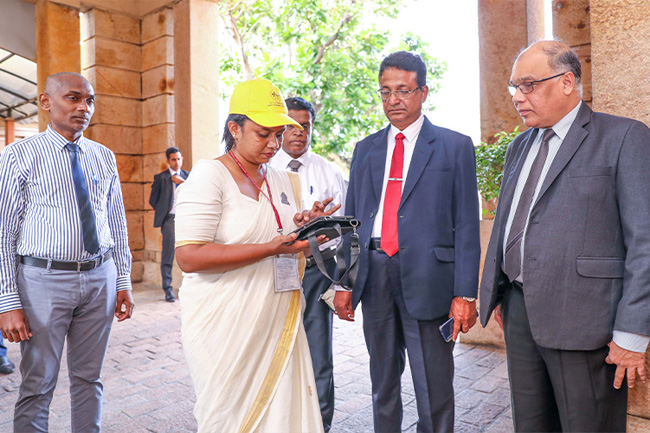
The 15th Population and Housing Census conducted every ten years commenced this morning (Nov. 01) at the Presidential Secretariat in Colombo.
Notably, the Presidential Secretariat was the first edifice catalogued in this decennial census.
A remarkable feature of this year’s census is the fusion of modern technology with conventional paper documents for data collection. The deployment of tablet computers, Internet connectivity and geospatial technologies is a standout feature. The President’s Media Division (PMD) said Computer Assisted Personal Interviewing (CAPI), is being employed here for the first time.
The listing phase, which is currently in progress, will be followed by the enumeration phase in 2024, according to the Department of Census and Statistics.
The Population and Housing Census entails a comprehensive tally of all individuals and existing residences within a country over a specific timeframe.
The process ensures that no person or dwelling is omitted or counted twice, the department emphasized.
Population and Housing Census is the main source of official data for obtaining population and housing information down to the Grama Niladhari Division level.
For this year’s census, around 16,000 enumerators were recruited, all of whom are government sector employees. Training of officers involved in the listing stage has already been started at the Divisional Secretariat office.
Sri Lanka’s Population and Housing Census is conducted every ten years and is overseen by the Department of Census and Statistics.
The previous census took place in 2012. Interestingly, the inaugural legally mandated census in Sri Lanka transpired on March 27, 1871, marking a pioneering scientific endeavour among South Asian nations.
The Population and Housing Census is a vital source of data for shaping national policies, and public administration and understanding demographics, ethnic distribution and other social characteristics.
The census encompasses housing information at the village’s official division level. This comprehensive undertaking includes assigning a unique number to every building and obtaining GPS coordinates for each structure. Additionally, it results in digitized maps at the village’s official division level.


